
You step out of the pines onto white sand, and a lone bus shelter faces the sea. It was never a working stop. The shelter was built for a photo shoot, taken down, and put back for the people who now come looking for it, and the scene is meant to recall the album jacket that made it famous.
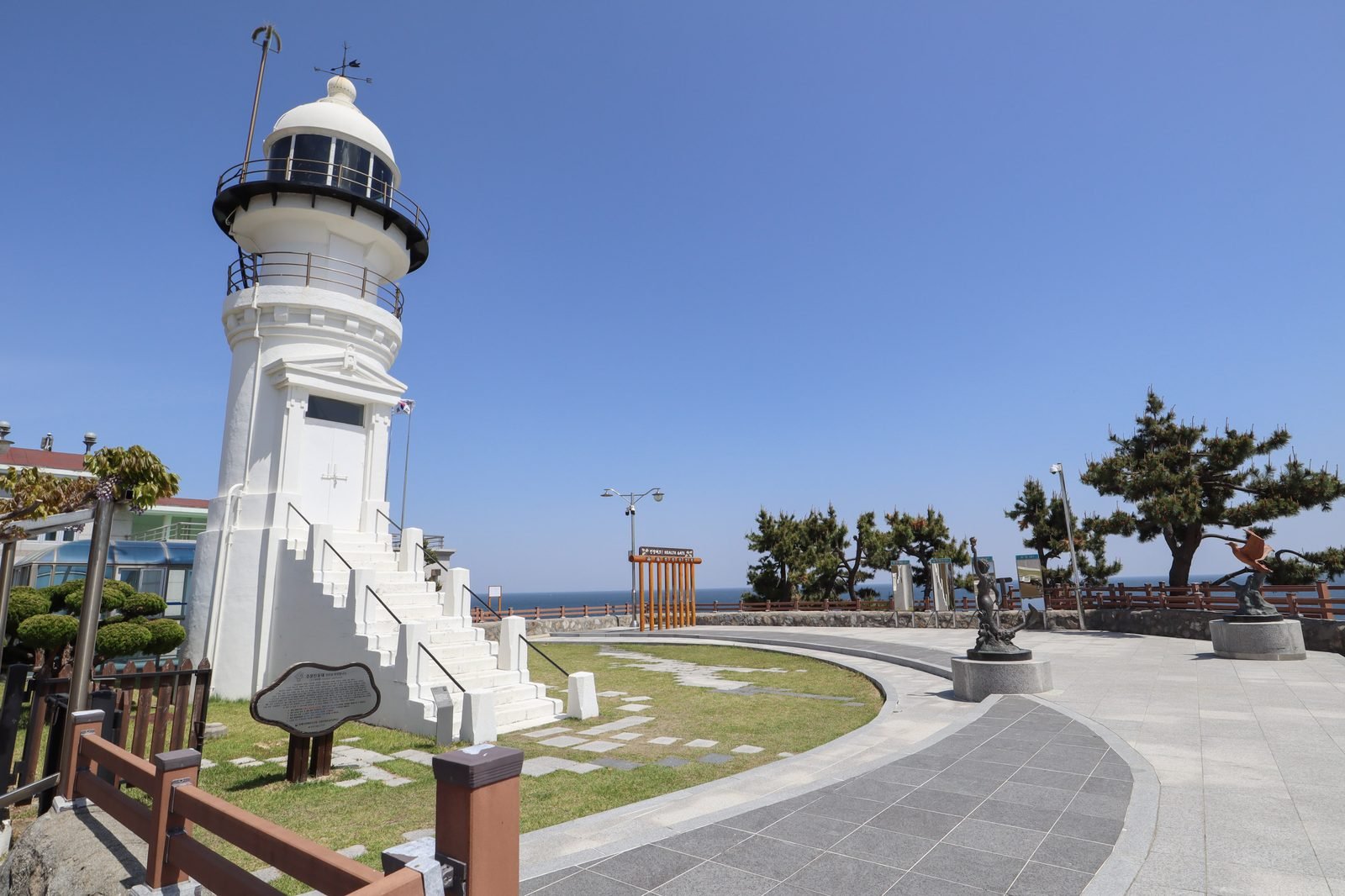

A Shelter Built for One Shoot and Rebuilt for Fans
The stop stands beside Jumunjin Beach at Hyangho-ri, in Jumunjin-eup, Gangneung, on the east coast. The Korea Tourism Organization’s feature on K-pop album jacket locations in Gangneung and Samcheok says the stop made for filming was not an actual one, was demolished after the shoot and was rebuilt at the request of fans, becoming a famous photo spot. Both the feature and the listing for Hyangho Beach tie it to the jacket for “Spring Day”.
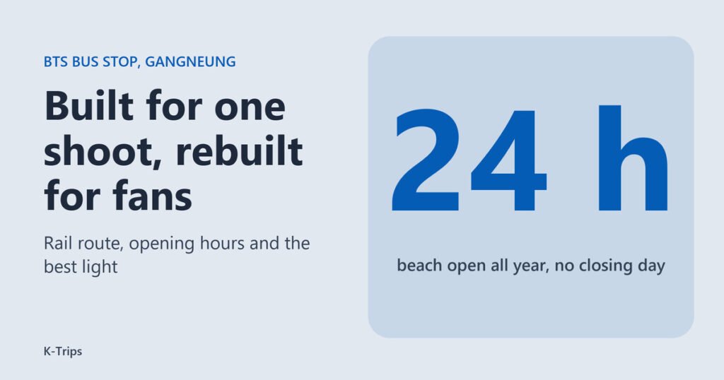
That history changes what you are visiting. This is not a heritage site with a keeper and a gate. It is a photo zone that exists because fans asked for it. The listing gives opening hours as 00:00 to 24:00 with no closing day, says parking is available, and shows no admission fee line. Its inquiry number is +82-33-640-5420.
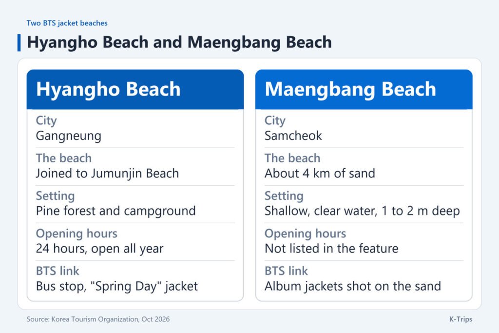
Hyangho is also not the only BTS jacket beach on this coast. The same feature points to Maengbang Beach in Samcheok, where more BTS album jackets were shot. It is known as Myeongsasimni, “ten li of sand”, because the sandy field runs about 4 km, and the water is shallow and clear, 1 to 2 m deep. The feature calls Hyangho a small beach connected to Jumunjin Beach, with a pine forest and a campground behind it. The two suit different days: Hyangho is a short stop inside a Gangneung plan, while Maengbang belongs to a Samcheok plan of its own. The comparison below sets out what the tourism pages say about each. To string several jacket locations into one trip, see planning a K-pop trip around Korea for the wider picture.
Rail to Gangneung, Then Bus or Taxi to the Sand
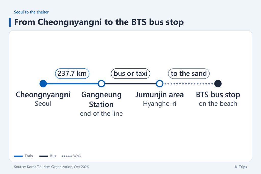
The train leg is the easy part. The Korea Tourism Organization’s rail page says KTX trains leave Seoul Station, Yongsan and Cheongnyangni, with routes that reach Gangneung, and describes the Gangneung line as 237.7 km long from Cheongnyangni, with stops including Yangpyeong, Seowonju and Pyeongchang. Tickets can usually be bought from one month ahead at 07:00, which matters if you want a weekend seat. Fares and journey times vary by train and date, so read them off the booking screen of Korail, Naver or KakaoT instead of trusting a number copied from an older post.
Travelling from the south changes the picture. A VisitKorea feature on the Donghae Line reports that the KTX-Eum semi-high-speed train began running the whole line on 30 December 2025, cutting the journey between Busan’s Bujeon Station and Gangneung Station to about 3 hours 50 minutes, with six daily services, three in each direction. The stops in between include Samcheok, the city of Maengbang Beach, and Jeongdongjin, whose beach the feature names as one of Korea’s most iconic sunrise spots. With so few departures, a Busan visitor has to build the day around the timetable, not the other way round. The feature’s FAQ adds that tickets can sell out quickly on weekends and in the summer holiday season, so it recommends booking a round trip in advance through KORAIL Talk.
Read together, the two pages give you two ways in. From Seoul you take the Gangneung line to Gangneung. From the south you ride the Donghae Line north through Samcheok, Donghae, Mukho and Jeongdongjin, and Gangneung comes after them. Either way the rail part ends at Gangneung Station, and the tourism pages stop there too, which is why the last stretch needs its own check.
The last stretch is where plans go wrong. The beach sits at the Jumunjin end of Gangneung, and neither tourism listing names a bus line or a timetable for it, so treat any bus number you read elsewhere as something to verify on the day. The reliable method is to search Hyangho-ri, or the Korean name 향호해변, in Naver Map or Kakao Map, which will match the address the listing gives. Compare the bus result with the taxi fare the app shows before you commit to either.
Build the day backwards from the train. With reservations opening one month ahead, book the outbound seat first, then the return, and leave at least an hour between walking off the sand and the last train you could still catch, because the final stretch comes with no published timetable to lean on.
Sunrise Light and a Level Horizon
An east-coast beach faces the water the sun rises from, so a morning visit puts the first light over the sea, and the Gangneung and Samcheok feature says the sea becomes the background when you sit at the stop and take a picture. The clock time of that light moves by hours between midsummer and midwinter. Korea’s national astronomy institute, KASI, publishes a sunrise table by month that lists Jumunjin among its Gangwon places, so pick your month there before you pick an arrival time. If the sky is overcast, go anyway: flat grey light removes harsh shadows from a plain shelter.
Open the jacket image on your phone before you arrive and decide what you want to match. The shelter was rebuilt after the original came down, so it may not match the shoot in every detail, and the surroundings are a public beach with sea, sand and pines rather than a staged set. Keep the horizon level and step back a few paces so the empty sand takes up much of the frame, because that emptiness is most of the effect.
Behind the sand lie the pine forest and campground that the listing mentions, and the beach runs on into Jumunjin Beach, so the stop is one point on a long shoreline, not an isolated site.
If sunrise from a station platform appeals more than a shelter, the Donghae Line feature sends you to Jeongdongjin, one stop before Gangneung, where the beach is a three-minute walk from a station the feature calls the world’s closest to the sea. Sunrise is the whole idea behind Seongsan Ilchulbong at dawn on Jeju too, though that one needs a climb and a ticket.
Swimming Is Off Limits Without Lifeguards
Swimming is not allowed outside a beach’s official swimming period because lifeguards are not on duty, and the FAQ at the end of the Donghae Line feature adds that it is banned at night even inside the period. Hyangho’s listing gives no swimming dates, so treat the visit as a walk on the sand and call the number above before you plan anything in the water.